Grebbedijk area development: designing for flood protection, nature and heritage
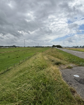
How do you design and reinforce a dike in an area where flood protection, nature, heritage and recreation all matter? For the Grebbedijk area development, Iv worked on behalf of Vallei en Veluwe Water Authority to design a solution that strengthens the dike and improves the surrounding area. This article explains the distinctive challenges and design choices behind the detailed design.
The Grebbedijk protects approximately 250,000 residents of the Gelderse Vallei from high water levels in the Lower Rhine. The national assessment of primary flood defences found that sections of the dike no longer meet current safety standards. The dike will therefore be reinforced over the next four years.
At the start of the construction phase, several uncertainties remained, particularly regarding existing structures in and beneath the dike. Sheet pile structures are present at several locations, but information about their configuration and remaining service life was unavailable. Commissioned by the Konikswaard joint venture of Boskalis Nederland and Wetering, Iv therefore prepared an extensive investigation plan. The findings formed the basis for the detailed design.
The dike section lies in an area where many functions converge. The floodplains along the Lower Rhine form an important ecological corridor between the Utrechtse Heuvelrug and the Veluwe. The historic hornwork, part of the Grebbe Line, is also located here and must be preserved. Protected bird species also breed in the area, which means that construction will take place over several years and in a specific sequence.
Major changes are also planned around the Grebbedijk. A channel will be excavated in the floodplains to meet Water Framework Directive objectives and provide ecological compensation. The excavated clay will be used to construct stability berms, allowing the material to be reused within the project. Riverbanks will also be modified to create an ecological corridor. This requires specific engineering solutions, including new revetment and modified slopes.
The design also takes protected species, recreation and access to the area into account. The challenge is to create a safe dike that also fits into the landscape.
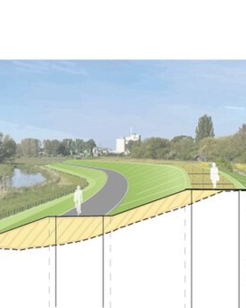
A detailed reference design was already available during the tender phase. However, information about the subsoil, existing structures and the feasibility of some measures was still missing. The team therefore excavated trial trenches, investigated the structures and carried out additional stability and piping calculations. At the same time, the team assessed whether the proposed measures could genuinely be built and implemented. Key questions included: can a sheet pile wall be installed here without damaging the surroundings? If so, is vibratory installation or press-in piling the better method? Can excavation take place here without temporarily weakening the dike?
A key part of the work was the investigation of existing sheet pile structures, including the cellular cofferdam near the hornwork. Trial trenches, steel thickness measurements and magnetocone penetration tests were used to establish which structures were present, their current condition and the depth of the sheet piles. This made it possible to assess whether the structures still meet the flood protection requirements. Reuse proved possible at several locations: the existing structures have a remaining service life of at least fifty years. This limits the extent of the works and reduces costs.
Not all existing structures can remain in place, however. The former Witte Sluis lies beneath the Grebbedijk. Although it is no longer in use, it could affect the behaviour of the dike and must therefore be removed. This is technically complex, partly because flood protection must be maintained throughout the works.
A stability berm is required on the landward side to prevent slope failure. The berm in the reference design was safe, but its width had a substantial spatial and visual impact. Further analysis allowed the berm to be reduced from approximately half to one-third of the retaining height. This means less earthwork and a more compact profile, while still meeting the stability standard.
To limit piping, the design uses a combination of steel and plastic heave barriers. Piping occurs when seepage carries sand away from beneath the dike. The barriers extend into the sand layers beneath the dike and prevent seepage beneath and around the structure. By lengthening the seepage path and increasing resistance, they reduce the risk of sand being carried away. The selection was based not only on performance, but also on constructability and the impact on the surrounding area.
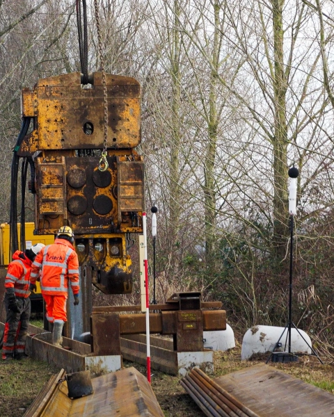
Where space is limited, for example near homes or businesses, longitudinal structures in the form of steel sheet pile walls will be used. The best installation method was then investigated. Vibratory installation is faster but causes more vibration in the surrounding area. Local piling trials were used to assess different construction methods. The results show were vibratory installation is feasible. Where vibration could damage nearby buildings, the team will press the sheet piles into the ground instead.
Following the high-water events of 1995, sections of the Grebbedijk were reinforced with sand by installing a sand wedge in the landward slope. Sand is relatively heavy and provides good stability, but is less compatible with the intended structure of a clay dike. The sand wedge will therefore be removed as part of the current design. Sections of the landward slope will be excavated and rebuilt using clay and a stability berm. Because excavating a large section of the dike in a single operation would be risky, the work will be carried out in phases. Each stage will be analysed and checked in advance.
The reinforcement of the Grebbedijk and its surroundings is not simply a collection of separate measures, but a series of directly interrelated choices. Changes below ground affect stability. The design determines how the works can be built. And every intervention on site directly affects nature and how the area is used. The team will complete the detailed design in the coming months. A four-year construction period will then follow. If everything proceeds as planned, by the end of 2030 the result will be not only a safer dike, but also a more attractive, resilient and better-balanced area.
Images: Waterschap Vallei en Veluwe, ingenieursbureau Iv
Wouter, managing director Infra and also COO of Iv, would be delighted to discuss this with you! Get in touch via +31 88 943 3200 or send a message.